10 Best Mountain Bike Trails for Beginners Update
January 8, 2024
283 Views
0
SaveSavedRemoved 0

Table of Contents
One of the coolest features of mountain bike trails I like most is that none of any tracks gives you the same experience. Even riding in the same circuit is likely to offer various challenges each time you are cycling.
Typically, the moment of unpredictability in the game is one of the reasons why mountain biking has attracted lots of fans. Moreover, searching for more challenging mountain bike trails has gradually become an obsession for most cyclists. The popularity of mountain bikes is on the rise as many online stores are now selling mountain bikes like hotcakes.
This article intends to inform about best beginner mountain bike trails. I have done numerous researches on several best mountain bike trails in the U.S., ranging from well-known, established circuits to unfamiliar routes. Finding decent mountain biking trails can be overwhelming, especially if you are a beginner cyclist. Why don’t you let the expert do the job for you? In this article, I have brought you a set of 10 best mountain bike trails for beginners in the U.S.
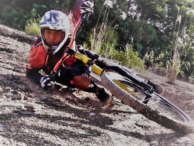
Decide which trail you should challenge, then grab your full-suspension mountain bike and enjoy the ride. By the way, if you are looking for an affordable bike, let’s check our list of best mountain bikes under $500
One of the most famous Moab mountain bike trails in Utah. This trail is the paved main road leading to the national park with an uphill slope at the entrance. Even though most people drive through, the spectacular views along the route make this trail an excellent choice for a beginner mountain bike ride. To avoid getting heatstroke during the hot summertime, you should start cycling before dawn and finish the trip within 2-3 hours.
Also, there are two sets of mountain bike trails to challenge this route, and both lead to the same destination. The first one is a simple gravel road with a moderate challenge. This trail is marked on the official Arches National Park map, or you may opt to use the Google map instead. The latter path starts at the Delicate Aches viewpoint. This trail is much more challenging for an experienced cyclist because of a much stricter gravel road condition.
Due to the popularity of Moab mountain bike trails among cyclists, hotel accommodation and airfare usually double during peak season. Therefore, it is advisable to travel during the off-peak season to avoid crowded tourists. Additionally, the temperature during summertime may rise over 95 ˚F and can easily cause a heat stroke. Therefore, always bring along a bottle of water with you and make sure to refill it whenever the water is available. The visitor center and the turnaround point provide water for refills.
TYPE: Paved road with little shoulder, DISTANCE: 35 miles, UPHILL: 2,100 feet, DOWNHILL: 1,200 feet, ELEVATION: 5,232 feet
We are still in Utah to look for another decent Moab mountain bike trail for beginners, and the Bar M Loop trail has just stood out on the top of my list. This trail is not far away from Arches National Park Main Road. Compared to the mountain bike trail in Arches, this one is much easier, which some cyclists label as a pretty lame mountain biking trail. Professional cyclists might turn their back on the Bar M Loop trail, but this trail is perfectly fit for novice mountain bike cyclists.
Although being considered an easy mountain bike trail for pros, the Bar M Loop trail still offers some challenging Slickrock roads to test your control. Also, you can perform a drop technique during cycling along the way. It is the perfect place for beginner cyclists to train in some intermediate to advanced mountain biking techniques without risking themselves to great danger.
The drawback is that you will hardly find the trail slop to practice climbing and descending techniques. Kids may love it, but grown-ups will find this trail boring. If you are looking for a more challenging trail to test your skill, you may skip this trail entirely. However, if you want to find a place where your kids can enjoy riding the bike, the Bar M Loop is definitely on the top of the list.
TYPE: Doubletrack trail road, DISTANCE: 7 miles, ELEVATION: 4,570 feet
The Lower Loop Trail is one of the entry-level mountain bike trails in Crested Butte, Colorado. This trail offers a moderately challenging trail ride with some small climbing and descending slopes as it runs along the slate river. You can enjoy a spectacular view while pedaling your mountain bike through a singletrack trail road. Although being regarded as one of the most natural bike trails in Colorado, the lower loop trail still offers some challenging speed cycling.
The trail leads us to the bottom of a high valley surrounding numerous spectacular peaks and dense forests. This trail has an incredible 9,000 feet of elevation, which can make your ride tougher than you previously anticipated.
Typically, the lower loop trail itself is only 2 miles long. Still, this trail also connects with other Colorado mountain bike trails in the Crested Butte area like a network. If we include the upper loop trail, which directly connects to the lower loop, the maximum distance will be 10-12 miles of the mountain bike trail. Additionally, intermediate and advanced cyclists can test their skills on some rocks along the path. Overall, it is an ideal place for a family vacation.
The majority of the trail road is a single track running along the river, and you should expect to encounter some wild animals while cycling along this trail. Don’t forget to bring along a guide map or a good GPS watch if you don’t want to carry a load of books with you as it will prove to be useful later. Additionally, a word of advice for preventing altitude sickness, bring some oxygen bars along with you.
TYPE: Singletrack road, DISTANCE: 10 miles, UPHILL: 600 feet, DOWNHILL: 900 feet, ELEVATION: 9,101 feet.
Many cyclists choose the Corral trail as their first mountain bike trail to test or practice their skills. This trail is close to the beautiful Lake Tahoe. Once you enter the Lake Tahoe area, you have three options to choose from. First, you may park your car at the end of the paved road and pedal your bike up to the top of the Armstrong connector. Please be aware that the uphill slop is 4 miles long and make sure that you are physically fit for cycling on a sharp elevated road.
Alternatively, there is a parking lot available halfway point of the road leading to the Armstrong connector. This area is marked as the official starting point of the Corral trail. From this point, you need to pedal up 2 miles to reach the Armstrong connector. The last option is to take a shuttle bus service at the parallel fire road up to the top. Please check the shuttle timetable to avoid long waiting times because the service will be light during the off-peak season.
From the top of the Armstrong connector, you now have two options to take. If you are a beginner mountain bike cyclist, I suggest you take the sidewinder trail by going down from the Armstrong connector. Then follow the sign to the sidewinder trail. For intermediate and advanced cyclists who prefer a more challenging ride, you may opt to test your skill on the rock garden in the Corral trail. This trail will challenge you with large rock sections and many tabletops in which you can perform a log ride, tabletop, or rock-lipped jump and drop techniques. Both Sidewinder and Coral trails lead to the same destination. From this point, you can do a downhill ride until you meet the powerline trail. After crossing the bridge, you will cycle back to the parking lot.
Alternatively, you may take a Cedar trail for your mountain biking. This trail is a popular choice for motorbike and ATV trail rides. It connects with the Coral Trail via the Powerline road. Overall, this trail is suitable for all levels of cyclists. Enjoy a spectacular view while riding on one of the best mountain bike trails in California and the U.S.
TYPE: Singletrack trail, DISTANCE: 2 miles, ELEVATION: 6,355 feet
A part of Grand Teton National Park, Packsaddle Lake is well known for its remarkable scenic viewpoint along the trail road. This mountain bike trail is suitable for biking even during the summertime because most of the trail path is covered by dense forest. Technically, you are not likely to get a heat stroke since you will be cycling under the shade most of the time. However, do exercise more caution if cycling during the wet springtime as the trail is usually damp and slippery.
The parking lot is available a couple of miles away from the trailhead, so you may park your car before pedaling your bike up to the trail road. Generally, the trail road is pretty smooth with a long but moderately steep uphill road. To go to the lake, once you come across the fork after coming downhill, take a left lane. Along the way, you will witness the beautiful view of the Great Teton mountain on your left side. Be careful while cycling down to the lake because this downhill mountain bike trail is quite steep. After enjoying a beautiful view of the Packsaddle Lake and the Grand Teton, you can backtrack your way to the trailhead. The total cycling distance is approximately 5 miles.
TYPE: Singletrack trail, DISTANCE: 5 miles, ELEVATION: 6,784 feet
This trail itself may not be recognizable as a noteworthy trail for mountain biking trail in the U.S. It acts as a gateway to more outstanding trail paths. However, this easy mountain bike trail remains one of the excellent choices for beginners to practice various techniques of mountain biking.
The trail is divided into two paths. It begins by crossing the road from the parking lot and going straight down the river below before crossing it. The path in this section is a sandy double-track trail that is easy to ride. Once crossing the river, the path narrows down to a single track with some slit rock sections. From this point, the cycling will get tougher along the way to Bridal Veil Falls. Additionally, this route will connect with one of the loops in Dupont State Park, which houses many great bike trails.
While most of the trail path is smooth, be alert for some rooty bits, which sometimes pop up on the way during the trail ride. Furthermore, exercise your caution as some paths of the trail get pretty nasty with tons of slit rock sections, which you may test your skill on traction control.
TYPE: Singletrack, DISTANCE: 1.3 miles, UPHILL: 2,200 feet, DOWNHILL: 2,100 feet, ELEVATION: N/A
Bend, Oregon, has long been known for many terrific mountain bike trails and attractions. You might have heard about Benham Falls, Sun River, and Deschutes River. This singletrack trail starts from the west side of the Deschutes River and runs along the creek for 12.5 miles until switching its direction to follow the Sun River. Although this trail is suitable for beginner and intermediate cyclists in general, some sections require some MTB techniques to pass through. Overall, this is the Bend mountain bike trail for the family to enjoy.
Once you reach the Benham Falls, you will find the alternated route heading to Benham Butte on the west. However, if you continue cycling along the river, you will eventually come across the footbridge. From that point, you may ride along the river for 2.5 miles before reaching the Sun River. From there, you will find another alternated trail to your left leading to the Blackrock trail via the Lava field before entering the Lava Land Visitor Center on Highway 97.
This Oregon mountain bike trail passes through various national parks along the Deschutes and Sun Rivers. You will enjoy numerous remarkable scenes such as amazing waterfalls, the incredible formation of lava rocks, and a beautiful pine forest. Additionally, you may challenge yourself by pedaling your bike through many alternated routes. Signposts and maps can be easily identified along the trail road.
TYPE: Singletrack, DISTANCE: 14 miles, UPHILL: 400 feet, DOWNHILL: 1,000 feet, ELEVATION: 4,247 feet.
The entire mountain bike trail in Colorado is for beginner cyclists to practice their mountain bike skills. This 3.5-mile loop provides enough rock sections and jumping pits to test your fundamental skills on a mountain bike while keeping you safe from severe injuries. Most intermediate and advanced cyclists use the Rustler loop to warm themselves up before moving to more challenging trails nearby. Please also note that this trail is designed to ride in a clockwise direction only.
In this trail ride, you will start the course with a steep uphill slope and cycle clockwise along the loop before descending the hill at the end of the line. The Rustler Loop also connects with advanced, yet more challenging trails like Mary’s Loop, Horsethief Bench Loop, and Moor’s Fun Loop. The Horsethief Bench loop offers you multiple short singletrack rides to test your dropping and jumping skills. On the other hand, Moor’s Fun Loop is not recommended for beginner and intermediate cyclists. You may try this route if you don’t worry about carrying your bike on the shoulder while walking your way back.
If you want to enjoy a spectacular view of the Grand Valley along the Colorado River while riding, the Rustler Loop stands at the top of the list. Don’t forget to drop by if you come to the Grand Valley, Colorado.
TYPE: Singletrack, DISTANCE: 3 miles, UPHILL: 200 feet, DOWNHILL: 300 feet
This trail road is famous for various activities such as hiking, running, trekking, and mountain biking. During summertime, this trail might be overcrowded with hikers, trekkers, and mountain bike cyclists. You can primarily access the Courthouse Butte loop either from the north trailhead or from the south trailhead.
For south trailhead access, you may access via Bell Rock Vista and the pathway tailhead located south of the Bell Rock Pathway. Starting from Route 89A in Sedona, Arizona, take Route 179 and continue south for approximately 6.5 miles until coming across the Bell Rock Vista signpost. Make a left turn to the south trailhead. Please note that mountain bike cyclists can access the trail only from this trailhead.
For north trailhead access, you have to access via the Courthouse Vista tailhead located north of the Bell Rock Pathway. Starting from Route 89A in Sedona, Arizona, take Route 179 and continue south for approximately 5.2 miles, then take a left turn at the Courthouse Vista signpost to the north trailhead.
Cyclists usually pedal bikes in a clockwise direction. Once you come across the signpost indicating the Courthouse Butte Loop, the trail will narrow down and lead to Lee Mountain in the north. Alternatively, you may try the Llama trail, which is popular among mountain bike cyclists. This route will lead to the wilderness area before approaching Bell Rock. Please note that this loop provides no shade along the trail, and the temperature could be substantial during the summertime.
TYPE: N/A, DISTANCE: 5 miles, ELEVATION: 4,227 feet.
Beginner cyclists will love this track since it provides a moderate challenge with the same number of uphill and downhill slopes. This trail is well-paved and monitored by the Sacramento Municipal Utilities District. Besides uphill and downhill slopes, this trail also features moderate elevation and campgrounds.
If you want to set up the camp, consider doing it at Azalea Campground. Don’t forget to stock up on plenty of purified water, canned foods, and bear vaults. The nearest US Forest Service office is located on the 8-mile road. Also, the office does provide a map of the Crystal Basin.
TYPE: Singletrack, DISTANCE: 7 miles, UPHILL: 1,200 feet, DOWNHILL: 1500 feet, ELEVATION: 4,894 feet.